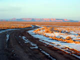
 | An Article from Aaron's Article ArchiveAstounding Images of Utah Photo: Caanan Mountain Above the High Desert PlainIPv4You are not logged in. Click here to log in. |
Use Google to search aarongifford.com:
Here is one of my web log entries, perhaps from my Yakkity Yak page, What's New page, or one of my Astounding Adventures from my Geocaching section: Astounding Images of Utah
Tuesday, 01 April 2003 6:13 PM MST
Astounding Adventures
Cache Found: Images of Utah
Tuesday, 1 April 2003 - 6:13 P.M. MDT (-0600) When I saw that this virtual cache had migrated to my neck of the woods, I had to take a break this evening and zip to it with my camera and snap a few shots. All it took was one glance at the online map of the location, and I knew exactly where it was: Zion National Park's Kolob Fingers scenic loop overlook. So around 5:30 P.M., I departed my abode in St. George and headed northward on I-15 to the New Harmony exit1, and thence wound my way through the park's winding scenic loop drive. Most folks cruising along Interstate 15, even if they notice the signs about this northwestern corner of Zion National Park, they don't realize how close they are to some of the most amazing natural sandstone sculptures nature has managed to produce. Mostly hidden from view by the Hurricane Cliffs paralleling the freeway to the east, are a series of sandstone mountains 7500 to 8000 feet high, stacked north to south, separated by deep sandstone canyons. These are the Kolob Fingers, carved from varied hued Navajo sandstone, remnants of ancient sand dunes. The scenic loop drive, paved and well kept, is open most of the year. It is a short, five-and-a-half mile drive, with a plentiful number of places to pull off, park, and look around. There are several trails, trail heads clearly marked with parking. At the end of the drive, is another trail head and parking lot. As I wound my way up the road, I just had to keep stopping to snap more shots. The setting sun was illuminating the west-facing cliffs in an ethereal light. It was stunning! The cache was almost right at the parking lot edge according to my G.P.S. I would have hit the coordinates right on, but for the steep slope covered with various trees and scrub where my G.P.S. said ground zero should be. I didn't feel like slipping and sliding down the hillside into branches and twigs another 15-20 feet to get an exact reading, so I hope my close reading in the photo will suffice. After finding the cache, and lingering to enjoy the amazing vistas spread before me lit by the evening light, I made my way back down the road, stopping again and again to gaze at the cliffs, canyons, and crevices as the light faded. Wow! Even though I've been here before, thanks for an excuse to visit again! Daily life sometimes makes me forget that treasures like these are so close and accessible. For the next cache finder, may I suggest the following G.P.S. coordinates. It's a spot atop a mesa with sweeping panoramic views that are best seen as sun sets in spring or fall. And it's not far from the very far from another cache, the Flying Monkey Mesa cache. The coordinates are: 37 deg. 19.149 min. North 113 deg. 11.894 min. West Thank you for a stunningly gorgeous cache location and an enjoyable evening find! -Astounding St. George, Utah 1 Since I originally wrote this log, I realized that the New Harmony I-15 freeway exit is the next one to the north of the exit I took (Exit 40) to go to the Kolob Canyons are of Zion National Park. | |