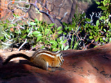
 | An Article from Aaron's Article ArchiveEvening Hunt at Gunlock Reservoir Photo: Chipmunk on Sandstone in ZionIPv4You are not logged in. Click here to log in. |
Use Google to search aarongifford.com:
Here is one of my web log entries, perhaps from my Yakkity Yak page, What's New page, or one of my Astounding Adventures from my Geocaching section: Evening Hunt at Gunlock Reservoir
Wednesday, 11 July 2001 8:55 PM MDT
Astounding Adventures
Cache Visited: Gunlock Cache
Wednesday, 11 July 2001 - 8:55 PM MDT (-0600) Gunlock Reservoir, Utah This is only my second day ever hunting GPS stashes, so I'm hitting all the ones close by. After a blistering hot Southwestern Utah summer day (100+ degrees Farenheit) I decided to wait for evening in hopes of cooler temperatures. Wise move. The drive from St. George, Utah to Gunlock Reservoir was a pretty one as the sun was setting. The red mountain north of Ivins, Kayenta, and the Shivwits Paiute reservation looks best in the long light of sunset. The Santa Clara river bottom, where the road follows, winding along the side of the river valley, was in places 10-15 degrees cooler than the hot desert air back in St. George. The cooler air beneath the cottonwood trees made the drive very pleasant with all my windows rolled down. --==++**++-==-- Before I left, I printed out a small topographical map of the immediate area around the cache with the cache site in the center, as well as a Geocaching.com notice (since Moroni, the last visitor who posted to the web site mentioned it could use a printed notice/README). I also put in the cache coordinates as a waypoint (I'm still rather new to this GPS stuff) on my eTrex Vista and used its Find/GoTo feature for the first time. It was fun watching the compass display with the arrow pointing towards the cache, the mileage to the cache slowly counting down as I drove. So when I arrived at the dam and parked on the west side, GPS in one hand and map in the other, it was easy to see exactly where to go. Is that cheating? The sun was just barely down behind the hills to the west, and evening twilight at the lake really brought out the colors, the thin line of green trees bordering the shore, the sandstone hills surrounding the lake, peppered with juniper trees. Wow, it was gorgeous! The final leg to the cache, from the end of the dam up the knoll was a brief but strenuous climb for someone as unfit as myself. But it didn't last long. On top the top of the knoll, I could see a full 360 degree vista, from the Ivins red mountain to the east, south to Utah Hill, the standstone hills west, and the lake to the north. Sorry to sound redundant, but WOW, wow, WOW! Very nice cache location! It took me 5 minutes to pinpoint the cache, a clear plastic container beneath a bush, the warped lid held down with a rock. --==++**++==-- I intended to take the seashell and leave a purple plastic magnifying glass. I also left the printed map and notice, but I didn't put them in the ziploc bag with the log notebook so they may fall apart in the next rainstorm. After waxing verbose in the log notebook, the twilight dimming towards night, I carefully replaced the cache, lid, and rock, and descended the opposite hillside to the reservoir overflow, rounded the knoll by the lakeshore, crossed the dam again, and returned home. The drive home was just as pretty in the dimming twilight. When I finally did get home to show my roommate the seashell, I came up empty. I don't know if I lost it somewhere between here and the cache, or if I just forgot to take it. Please, whoever visits the cache next, let me know if the seashell is still there in your post to this website1. --==++**==++-- Thank you very much, Jim, Angela, and Amanda, for a fun, quick evening hike in a gorgeous setting! 1 This log entry was originally posted on www.geocaching.com | |