 | An Article from Aaron's Article ArchiveGorgeous Hike to Snow Canyon Overlook Photo: Indian Paintbrush and Chain in SandstoneIPv4You are not logged in. Click here to log in. |
Use Google to search aarongifford.com:
Here is one of my web log entries, perhaps from my Yakkity Yak page, What's New page, or one of my Astounding Adventures from my Geocaching section: Gorgeous Hike to Snow Canyon Overlook
Tuesday, 02 March 2010 9:13 PM MST
Astounding Adventures, Yakkity Yak
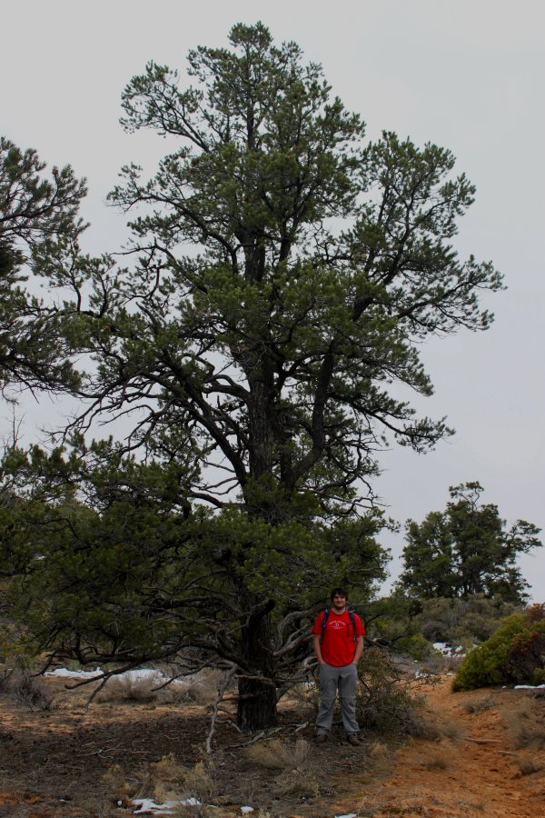 Kendall on the Trail Beneath a Pine Kendall on the Trail Beneath a Pine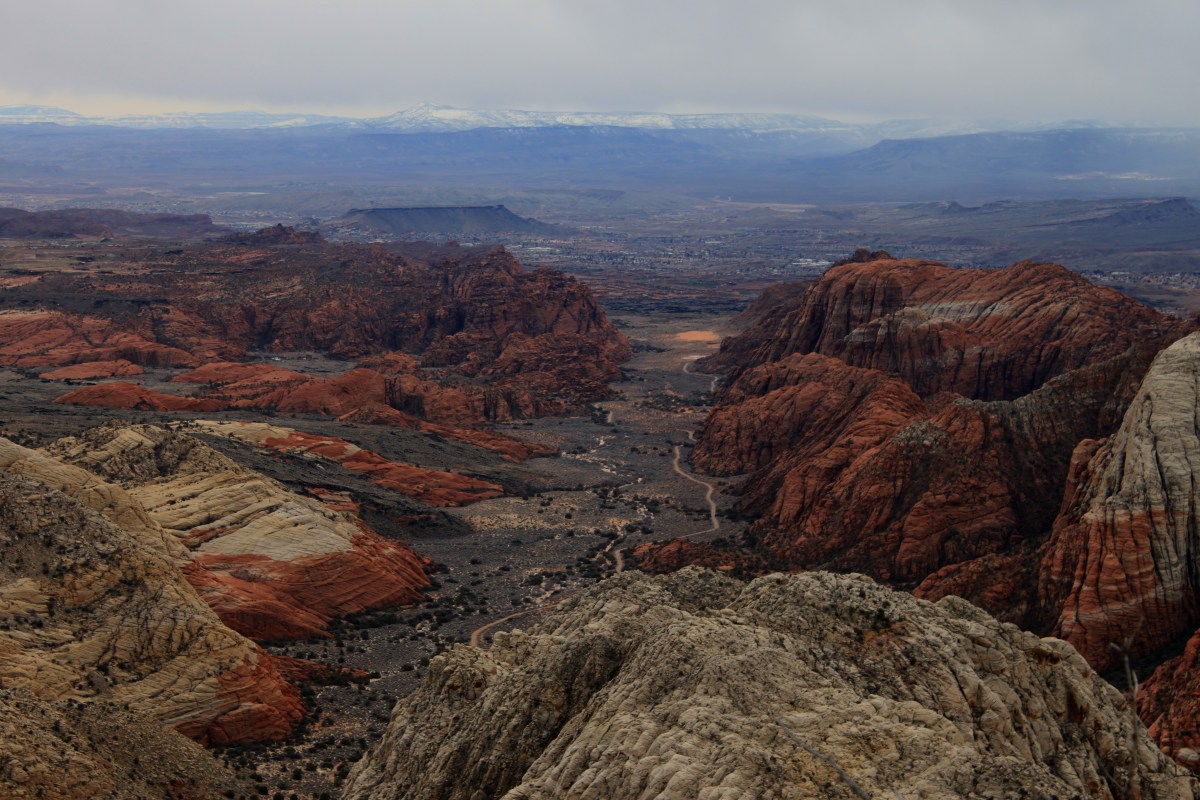 Overlooking Snow CanyonOn Saturday, 27 Feb. 2010, my brother Kendall and I decided to go hiking. It was a beautiful day—overcast with low clouds encroaching and enveloping the surrounding mountains, threatening to rain. When you live in red rock desert county, rainy days bring out the desert colors. Temperatures were in the forties (Fahrenheit), but with no wind, with a light jacket, that's perfect for hiking. Overlooking Snow CanyonOn Saturday, 27 Feb. 2010, my brother Kendall and I decided to go hiking. It was a beautiful day—overcast with low clouds encroaching and enveloping the surrounding mountains, threatening to rain. When you live in red rock desert county, rainy days bring out the desert colors. Temperatures were in the forties (Fahrenheit), but with no wind, with a light jacket, that's perfect for hiking.
Kendall's Utah State Park pass was about to expire, so we decided to visit nearby Snow Canyon State Park. As we reached the intersection with State Route 18, we decided to turn north on 18 and enter the park at the north entrance just north of Winchester Hills. 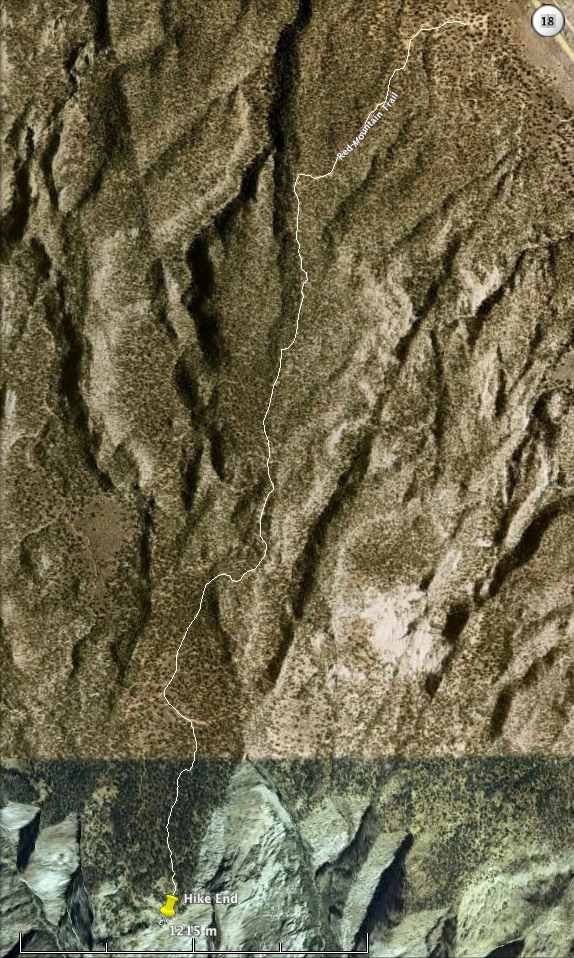 Snow Canyon Hike RouteBefore we reached the entrance, however, we decided to continue past, up through Diamond Valley, and a tad beyond, to the Red Mountain Trail trailhead. I wanted to revisit a hike I'd made years ago to a virtual Geocache at the top of Snow Canyon, a hike Kendall had done many times as a guide working for Red Mountain Spa. Snow Canyon Hike RouteBefore we reached the entrance, however, we decided to continue past, up through Diamond Valley, and a tad beyond, to the Red Mountain Trail trailhead. I wanted to revisit a hike I'd made years ago to a virtual Geocache at the top of Snow Canyon, a hike Kendall had done many times as a guide working for Red Mountain Spa.
Just outside of Diamond Valley, as State Route 18 made a bend towards the north, aiming us almost directly at the cinder cone up ahead that stands above the community of Veyo, between Veyo and the even-closer Dammeron Valley, we stopped, leaving the road, turning left (west) onto a dirt road—well more of a dirt driveway and parking lot among the juniper and piñon pine trees beside State Route 18. There we parked, amidst a herd of trucks attached to horse trailers. Apparently the equestrians were out in force this cloudy, cool day. And indeed they were! We saw riders galore as we embarked on the sand-and-rock Red Mountain Trail, beginning our slow ascent, twisting through the trees up the gentle hillside slope. Having had significant surgery in September of 2009, returning to a semblance of normal life only by December, I certainly could feel my frailty as the trail wound ever higher up the hill, heading first southwestward, then nearer the ridge summit, turning south to follow the summit towards Snow Canyon. I was soon huffing and puffing, but grateful that I could do this hike. Once we reached the top of the ridge, we paused and looked around a bit, sipping our water bottles. Pine Valley Mountain remained enshrouded in clouds, only the lower foothills, sprinkled with a light dusting of new snow, visible. Wisps of clouds trailed gently down the slopes, a warning to us that should the weather change, the sky could quickly lower and envelope us in mist, rain, or even snow. We resumed our hike southward, and remained dry for the time being—well, free of rain, though not completely dry, as hiking even with a light jacket in cool air had me sweating. The recent-rain-moistened red sand of Southwestern Utah beneath our feet really made the brilliantly white, thin patches of melting snow that lurked atop the ridge wherever shade afforded protection from the sun's warmth stand out sharply in contrast. Wow! Beautiful! 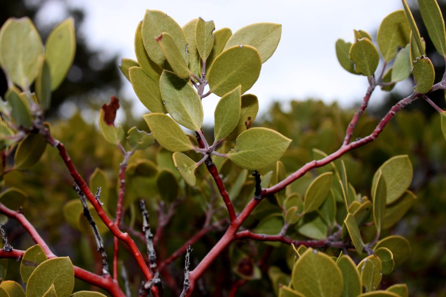 Manzanita above Snow CanyonWe stopped several times the latter part of our hike out to the top of the canyon and snapped photos. It's always beautiful to see open white and red sand and also undisturbed cryptobiotic soil crusts, sandstone rocks, lichen-encrusted rocks, manzanita shrubs, their thick oval green leaves contrasting their smooth reddish bark, yucca, cacti, junipers, and significantly taller piñon pine trees—they seemed to grow better or at least taller at the somewhat higher altitude nearer our destination. Manzanita above Snow CanyonWe stopped several times the latter part of our hike out to the top of the canyon and snapped photos. It's always beautiful to see open white and red sand and also undisturbed cryptobiotic soil crusts, sandstone rocks, lichen-encrusted rocks, manzanita shrubs, their thick oval green leaves contrasting their smooth reddish bark, yucca, cacti, junipers, and significantly taller piñon pine trees—they seemed to grow better or at least taller at the somewhat higher altitude nearer our destination.
The last part of the trail, instead of a rough, broken-sandstone-rock old jeep trail, was a soft, sandy path, the sand growing deeper—making me even more grateful that it was wet which makes it firmer, and walking easier. Kendall, ahead of me, followed the trail around a bend, through a cut about his height in a sand dune. On the other side of that dune, in a few more steps, we caught sight of the sandstone hilltops that surround Snow Canyon. A few more steps, and suddenly, a giant gaping chasm opened beneath our feet, and sheer sandstone cliffs halted our forward progress. We had arrived! Wow! What a view! Stretching before us, beneath us, were the several merging canyons in Snow Canyon State Park. White sandstone dominated to the left (east), red to the right (west), and in the misty distance, we could see parts of Santa Clara and parts of the Dixie Downs and Green Valley area of St. George. On the black lava basalt-edged bench to the right, perched Winchester Hills and The Ledges golf course. (Those who own homes there have a stunning view looking down into Snow Canyon from the western side.) In the far, far distance, a thin horizontal line was visible, the Hurricane Cliffs, and perched atop, a flat, familiar pyrmidal shape was visible, Mount Trumbull in Arizona, close to the edge of the Grand Canyon. I could also make out the closer Seegmiller Mountain south of St. George. Mount Bangs and Black Rock (south and southwest of St. George) were too cloud-enshrouded, as were West Mountain, Scrub Peak and the rest of the hills and mountains I grew up calling Utah Hill (part of the Beaver Dam Mountains west of St. George). Hike Destination at maps.google.com We spent quite some time there at the rim of the canyon. When we finally gathered our things for the return journey, weather looking even more ominous, a few droplets of water warning us of what could be coming our way, it was hard to depart that stunning locale. Wow, wow, wow, wow, WOW! I was in natural beauty overload. Despite the low clouds and what looked like fresh snow on the foothills of Pine Valley, it didn't actually rain on us until we were nearly back to our vehicle, and then it only sprinkled tiny droplets, almost a mist, so that we were barely wet when we did arrive. Once back in my RAV4 (the RAV4's steering fixed under warranty the day before the warranty expired, thank goodness!), the rain picked up just a bit, though it never really rained hard at all. It was beautiful. On our way back home, we did enter Snow Canyon State Park at the north entrance, and idled leisurely down the road, pausing so I could take a few more photos. What a beautiful place! I love it! 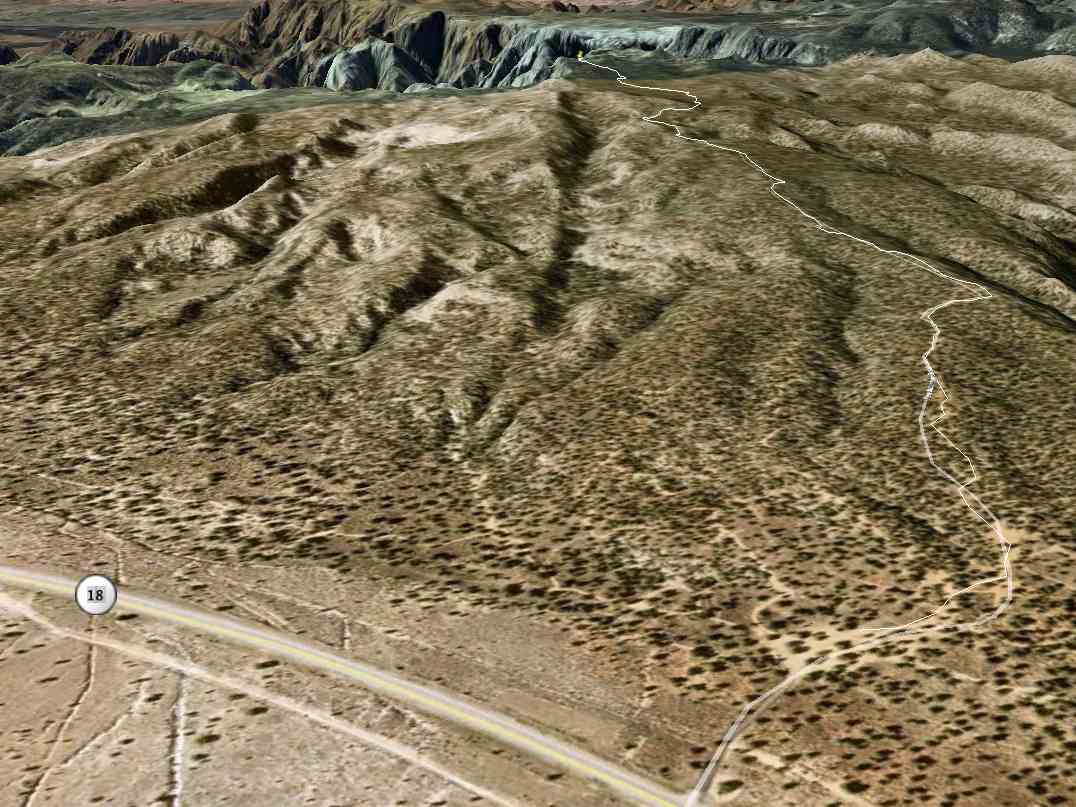 Snow Canyon Hike Route in 3-DThanks for the hike, Kendall! It was great to finally get back there. Snow Canyon Hike Route in 3-DThanks for the hike, Kendall! It was great to finally get back there.
All in all, having measured our route in Google Earth—check out the Google Earth screenshots of the route I've included with this post—we hiked only 4-and-a-half miles, two-and-a-quarter out, two-and-a-quarter back. For me, post surgery, that's doing well. I hope to be able to do longer hikes this spring and summer. In case you wonder where exactly our hike terminated, check out the embedded Google Map with the green arrow (at least it SHOULD be green—it was in my web browser) right at the top of the canyons where we stopped. What a blast! | |