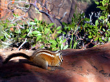
 | An Article from Aaron's Article ArchiveGot a New GPS - Found My First Cache Photo: Chipmunk on Sandstone in ZionIPv4You are not logged in. Click here to log in. |
Use Google to search aarongifford.com:
Here is one of my web log entries, perhaps from my Yakkity Yak page, What's New page, or one of my Astounding Adventures from my Geocaching section: Got a New GPS - Found My First Cache
Tuesday, 10 July 2001 4:00 PM MDT
Astounding Adventures
Cache Visited: Flying Monkey Mesa
Tuesday, 10 July 2001 - Afternoon Thanks for a fun cache find. It was my very first. My new eTrex Vista arrived by mail just yesterday and I couldn't wait to try it out. I drove to Hurricane, UT from St. George, UT, and grabbed my father. We looked up the coordinates using Topo! topographic map software, printed out maps with a guesstimated route to the site, and hit the road. When we were almost there I realized I'd forgotten to write down the coordinates, so my GPS unit didn't really guide us to the spot - the map did. Oops! *grin* Once in the area we split up and started searching the boulders on the hillside. In at most 10 minutes I stumbled across it. I was standing on a rock, noticing that below the rock some of the weeds were bent as if recent foot traffic had passed there - there was a bit of a trail - when the corner of the ammo box the stash is in caught my eye below my feet. Luck was with us. We left yet another Hot Wheels item (I didn't even know there were Hot Wheels items in it because I didn't thorougly read this web site before we left) and took the compass. The scenery in the area near the cache is gorgeous. I recommend that anyone who visits this cache continue on the main road northward to about North 37 degrees and 19.132 minutes by West 113 degrees and 11.073 minutes (this location is ON the road - a well maintained dirt road). While the Flying Monkey Mesa cache is on top of the Hurricane mesa, if you do follow my advice, you will end up on top of the next mesa, Smith's Mesa immediately above the Hurricane Mesa to the north. The dirt road eventually crests a hog's back of small hills, and looking out to the north and east are unequaled panoramic vistas of Zion National Park's red rock cliffs. Looking to the north are the even redder sheer cliffs of Kolob Canyons (also in Zion National Park), and to the west is Pine Valley Mountain. All around, the flat parts of Smith's mesa are dry farmed. Today the golden rye grasses were gorgeous (truly amber waves of grain) as above summer thunderstorms brewed, cooling the usually blistering heat of Southwestern Utah with a cool breeze. If you do continue north on Smith's Mesa, please respect the private land to either side of the road where posted. This is fun! Thanks for making my first GPS stash find so interesting, everyone. -Astounding St. George, Utah | |