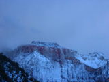
 | An Article from Aaron's Article ArchiveHiking Atop the Hurricane Hill Photo: West Temple in SnowIPv4You are not logged in. Click here to log in. |
Use Google to search aarongifford.com:
Here is one of my web log entries, perhaps from my Yakkity Yak page, What's New page, or one of my Astounding Adventures from my Geocaching section: Hiking Atop the Hurricane Hill
Thursday, 20 November 2003 7:00 PM MST
Yakkity Yak
Author's Note: I finally got around to posting these photos and writing a few descriptions in January 2004.
This entry is more of a photo essay. You should be able to use your browser's View Image function or feature to view a larger image for any of the images below. One afternoon, my brother Kendall and I decided to get our exercise hiking the Hurricane Canal Rim Trail. We started in the late afternoon, parking near the trailhead. Since I had a digital camera with me, that meant we paused often so I could snap shots. I sometimes get a little snap-happy with a camera in hand. The trail is one of several that are connected together and meander around. One branch descends into the canyon. We've hiked the rim trail from end-to-end before, as well as the canal trail (the one that descends into the canyon and back up). This day we stuck to the rim trail, hiking perhaps 2 1/2 miles or so before turning around and tracing our steps back to my car, for a 5 mile round-trip (or something close, maybe more, perhaps less). It was a blast. Here are some of the things we saw, some of the spectacular desert scenery, and some of our own craziness. I believe the pictures are in order as we hiked the trail. Enjoy! 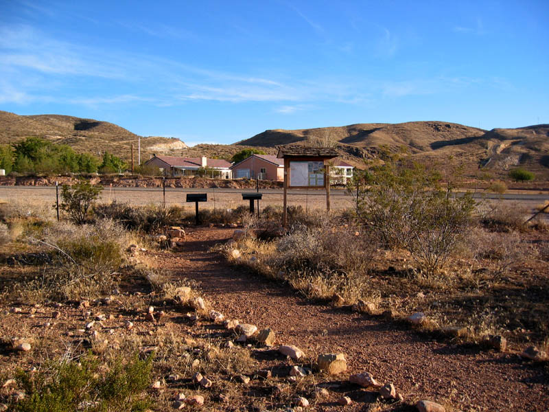 The Trail Head where we parked and began the hike. The Trail Head where we parked and began the hike.
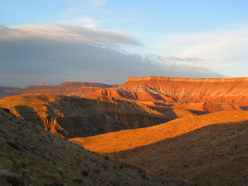
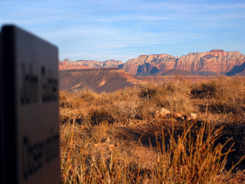 The cliffs of West Temple and Zion National Park in the late afternoon sun, as seen from atop the Hurricane Hill, looking east The cliffs of West Temple and Zion National Park in the late afternoon sun, as seen from atop the Hurricane Hill, looking east
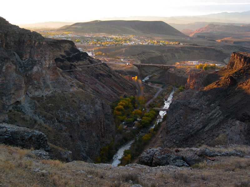
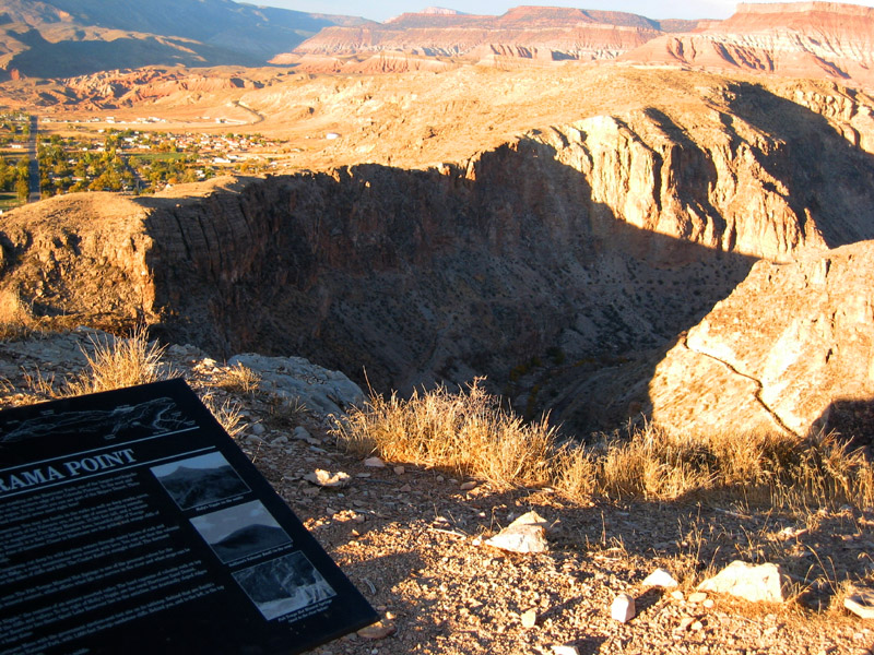 Looking down into the Virgin River canyon at Panorama Point. Notice that winding line part way up the slope from the bottom? That's the Hurricane Canal, carved into the side of the canyon walls with heroic effort by the pioneers of Hurricane Valley. Looking down into the Virgin River canyon at Panorama Point. Notice that winding line part way up the slope from the bottom? That's the Hurricane Canal, carved into the side of the canyon walls with heroic effort by the pioneers of Hurricane Valley.
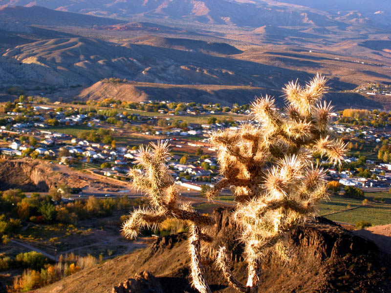 An interesting cactus near the trail, just past Panorama Point, overlooking the unseen Virgin River canyon directly below, and the neighboring town of La Verkin, Utah An interesting cactus near the trail, just past Panorama Point, overlooking the unseen Virgin River canyon directly below, and the neighboring town of La Verkin, Utah
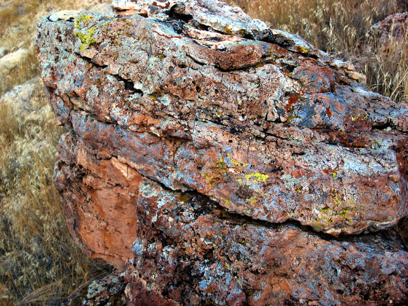 One of many interesting lichen-encrusted rocks beside the trail. One of many interesting lichen-encrusted rocks beside the trail.
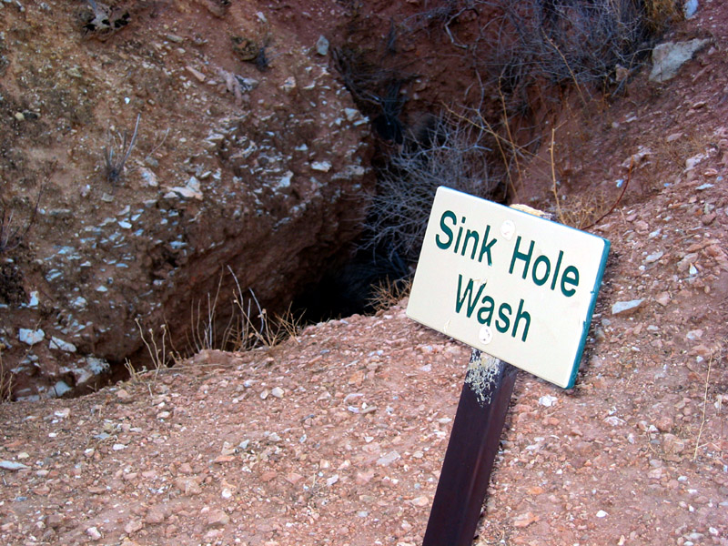 Aptly named, Sink Hole Wash had sink holes to spare. Aptly named, Sink Hole Wash had sink holes to spare.
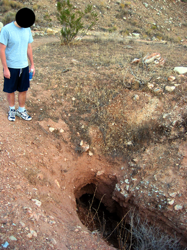 My brother, Kendall, gazes into the abyss of one of the sink holes in Sink Hole Wash. My brother, Kendall, gazes into the abyss of one of the sink holes in Sink Hole Wash.
 Looking westward, Virgin River below us glistening with the light from the sinking sun, not far from where we turned around Looking westward, Virgin River below us glistening with the light from the sinking sun, not far from where we turned around
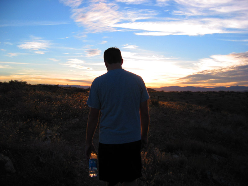
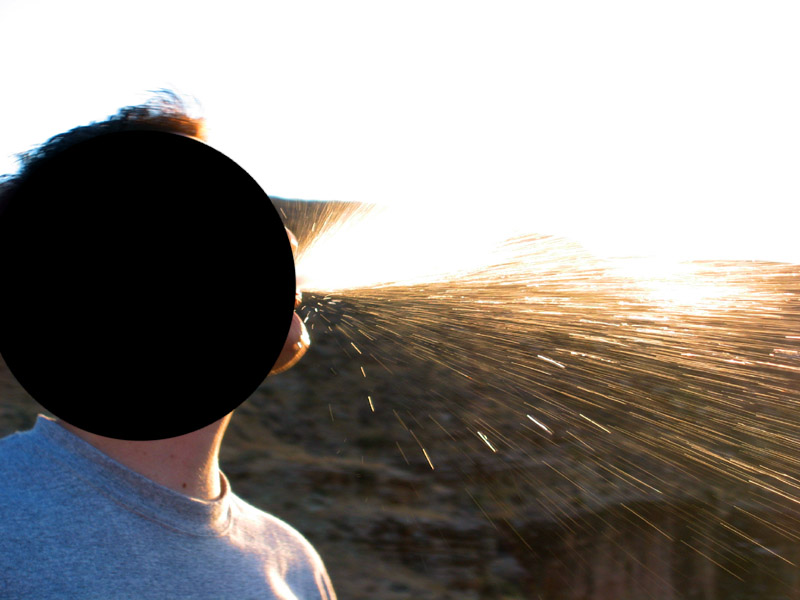 Not far from where we turned around, we got a little crazy. I tried repeatedly to capture a snapshot of Kendall spewing mouthfuls of his bottled water into the air. This is one of those snapshots. Not far from where we turned around, we got a little crazy. I tried repeatedly to capture a snapshot of Kendall spewing mouthfuls of his bottled water into the air. This is one of those snapshots.
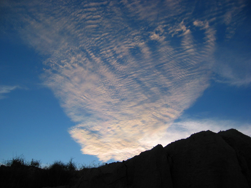 On the way back hiking up out of a small, side canyon to the top of the hill, the sun lit up an interesting blanket of clouds against a stunning blue sky. On the way back hiking up out of a small, side canyon to the top of the hill, the sun lit up an interesting blanket of clouds against a stunning blue sky.
 The setting sun illuminates the nearby Hurricane Mesa, across the river gorge. The setting sun illuminates the nearby Hurricane Mesa, across the river gorge.
 Again atop the Hurricane Hill, heading westward back the way we came, Kendall led while I followed behind, snapping pictures, including this one. Again atop the Hurricane Hill, heading westward back the way we came, Kendall led while I followed behind, snapping pictures, including this one.
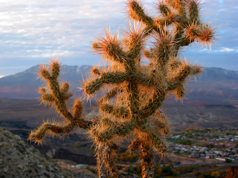 As we returned down the trail to where we started, the setting sun's final rays illuminated the needles of the same cactus I took a picture of earlier. As we returned down the trail to where we started, the setting sun's final rays illuminated the needles of the same cactus I took a picture of earlier.
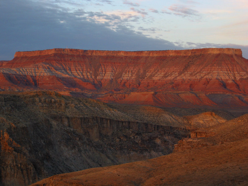 A close-up shot of the Hurricane Mesa as the sun's last light catches the convoluted topography of exposed strata, taken as we return back along the trail. A close-up shot of the Hurricane Mesa as the sun's last light catches the convoluted topography of exposed strata, taken as we return back along the trail.
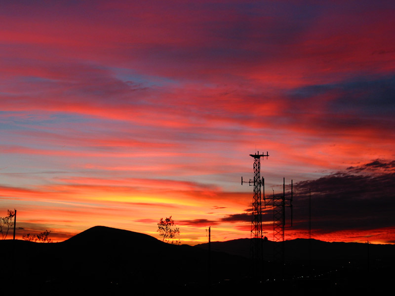
 Above us, the setting sun began an astounding light show in the sky above us, a sunset of ever-changing hues, dynamic and breathtaking. Above us, the setting sun began an astounding light show in the sky above us, a sunset of ever-changing hues, dynamic and breathtaking.
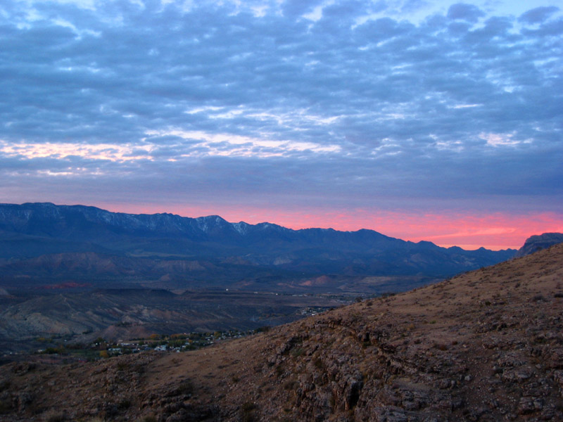
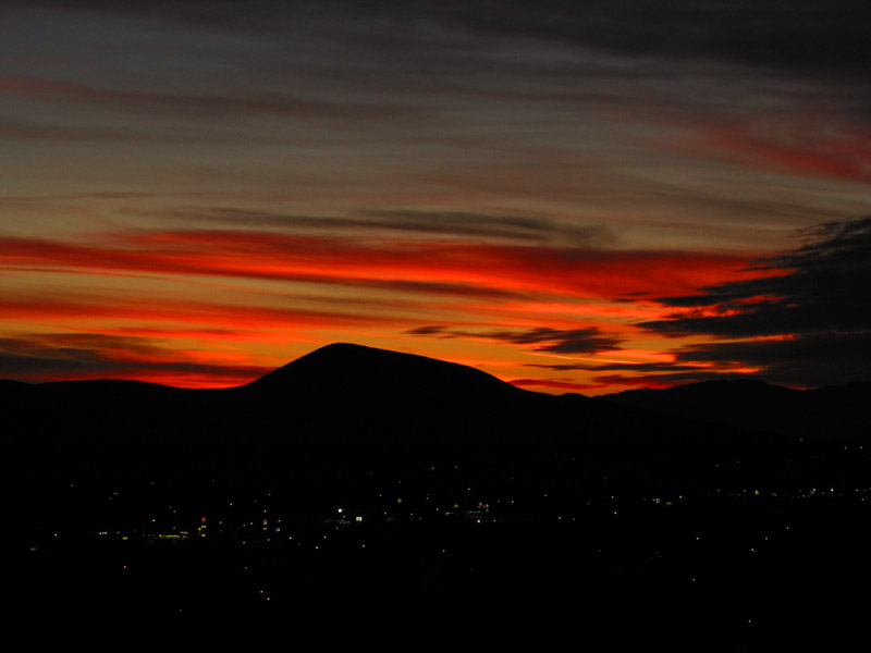
 The spectacular sunset wanes as we reach the end of the road, the trail head where we began the trek The spectacular sunset wanes as we reach the end of the road, the trail head where we began the trek
 Night descends on the peaceful valley of Hurricane, Utah Night descends on the peaceful valley of Hurricane, Utah
| |