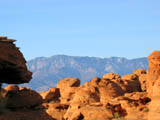
 | An Article from Aaron's Article ArchiveReturn to Flying Monkey Mesa Photo: Pine Valley Mountain Across Sand Mountain's RocksIPv4You are not logged in. Click here to log in. |
Use Google to search aarongifford.com:
Here is one of my web log entries, perhaps from my Yakkity Yak page, What's New page, or one of my Astounding Adventures from my Geocaching section: Return to Flying Monkey Mesa
Thursday, 30 August 2001 7:30 PM MDT
Astounding Adventures
Cache Revisited: Flying Monkey Mesa by CodyC
Thursday, 30 August 2001 - 7:30 P.M. MDT (-0600) My youngest brother just got back from serving a full-time mission for the L.D.S. church (www.lds.org) for two years on Tuesday. I decided to introduce him to GPS Stash Hunting (Geocaching) right away. My roommate, my brother, and I drove to the cache site, my brother acting as navigator with the GPS. Once at the site, my brother had to search alone (my roommate stayed in the vehicle and since I'd already found the cache before, I couldn't very well assist in the search). My GPS kept pointing to a spot higher up the hill and to the west by about 30-50 ft. from the cache itself. My brother searched all over, circling the GPS ground zero spot. Eventually he found it (maybe 20 minutes into the search). We took the ammo box back down to my vehicle so all three of us could peruse the contents. My brother added a log entry while I scouted the flat terrain below the hill for petrified wood and other interesting rocks. I don't think my roommate added a log. Neither did I (since I was the last finder with my father a month-and-a-half ago). While at the cache site, I took 4 separate GPS readings (hiking away from the spot and returning between each sample) of the cache location. The averaged location according to my GPS was: North 37 degrees, 14.585 minutes
Maybe this might help the next searcher. Try the actual cache coordinates, and if you don't find it after a search, try these coordinates and see if you find it.
West 113 degrees, 11.792 minutes After we replaced the cache (I believe my brother took the mini-dumbell and left a calculator), we drove up the road on top of Smith's Mesa so my brother could reacquaint himself with the panoramic vista of the cliffs of Zion National Park and Kolob (and so my roommate could see it for the first time). Hopefully my brother will write up a log entry here soon. - Astounding St. George, Utah | |