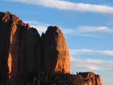
 | An Article from Aaron's Article ArchiveTrip to Toroweap Photo: April Sun Sets on Shuntavi ButteIPv4You are not logged in. Click here to log in. |
Use Google to search aarongifford.com:
Here is one of my web log entries, perhaps from my Yakkity Yak page, What's New page, or one of my Astounding Adventures from my Geocaching section: Trip to Toroweap
Thursday, 26 December 2002 2:00 PM MST
Astounding Adventures
Cache Found: One Giant Step in Arizona (Virtual Cache) by Taelon
Thursday, 26 Dec. 2002 - 2:00 P.M. MST (-0700)  The Snowy Road - For a goodly part of the trip south from Colorado City, Arizona to Tuweep/Toroweap Point, the road was snow-covered.The day after Christmas my parents and I decided to drive from Hurricane, Utah the overlook at Tuweep Point (or Toroweap Point depending on which way the map you use chooses to spell it). After preparing a picnic lunch and plenty of water and telling everyone where we were heading, we hopped into my vehicle and headed eastward down the highway to Colorado City, Arizona. The Snowy Road - For a goodly part of the trip south from Colorado City, Arizona to Tuweep/Toroweap Point, the road was snow-covered.The day after Christmas my parents and I decided to drive from Hurricane, Utah the overlook at Tuweep Point (or Toroweap Point depending on which way the map you use chooses to spell it). After preparing a picnic lunch and plenty of water and telling everyone where we were heading, we hopped into my vehicle and headed eastward down the highway to Colorado City, Arizona.
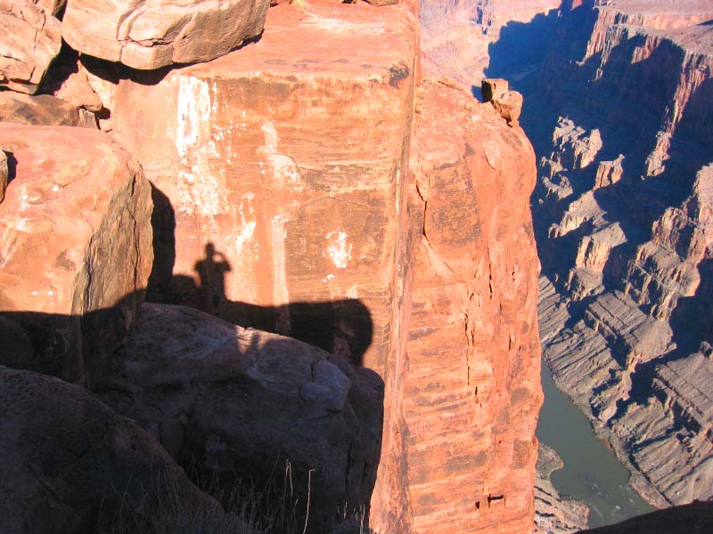
We were surprised as the highway climbed from the Hurricane valley to the high desert plains below Caanan Mountain to see that there was snow still on the ground. We are so used to the mild weather in Hurricane and St. George, Utah where snow never seems to stick around for very long that none of us thought to worry about it. Once at Colorado City, Arizona (the town on the Arizona side where the highway crosses the Utah-Arizona border) we turned westward, then southward, on to the snow covered dirt road that would be our route to Tuweep/Toroweap. At first we worried that perhaps the packed snow (there were many sets of tracks in the snow) might be a bit slippery, but our fears melted (though the snow didn't) as we continued southward.  Tuweep/Toroweap Point/Overlook - Looking upstream (eastward) along the Grand Canyon of the Colorado River. That's my shadow there on the sandstone cliff. Tuweep/Toroweap Point/Overlook - Looking upstream (eastward) along the Grand Canyon of the Colorado River. That's my shadow there on the sandstone cliff.
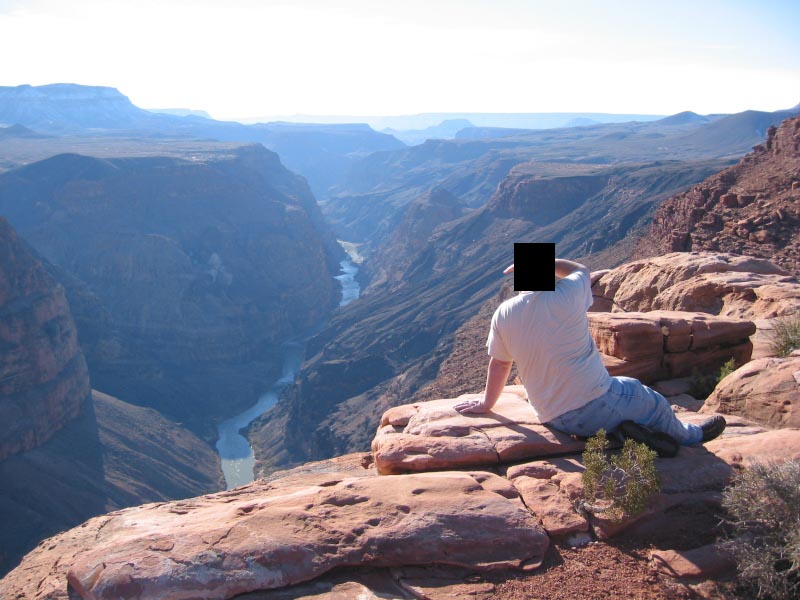
The inch or two of snow scattered across the desert plains made the drive southward toward Mt. Trumbull beautiful. This part of the road, during the heat of the summer, is much less interesting, looking more barren and desolate. Before long the road began descending into the valley that runs in a line southward, beginning just east of Mt. Trumbull (the mountain, not the ghost town) and continuing all the way to Vulcan's Throne, the volcanic domed hill at the edge of the canyon just east of Tuweep/Toroweap Point. As the we descended in altitude, the snowy road was spotted with bare patches of dirt, then soon it was the other way around, the dirt road with patches of melting snow, and then it was entirely dry.  The Grand Canyon and Colorado River - That's me looking downstream (westward) down upon the Colorado River (and Lava Falls) from Tuweep/Toroweap Point.We paused for a pit stop at the Tuweep Ranger Station (and the Ranger Station sign spells it Tuweep even though some of the National Park maps available at the information booth there show it as Toroweap - I guess even the NPS can't decide which way to spell it), then finished the last few miles of road to the overlook parking area. The Grand Canyon and Colorado River - That's me looking downstream (westward) down upon the Colorado River (and Lava Falls) from Tuweep/Toroweap Point.We paused for a pit stop at the Tuweep Ranger Station (and the Ranger Station sign spells it Tuweep even though some of the National Park maps available at the information booth there show it as Toroweap - I guess even the NPS can't decide which way to spell it), then finished the last few miles of road to the overlook parking area.
Wow! What a beautiful place! The overlook is at about 4500 feet elevation, with the mighty Colorado River slowly continuing to carve the canyon nearly 3000 feet below the overlook rim. It is simply stunning! But be careful! There are no guard rails to keep one from plummeting over the precipice. Red Navajo sandstone formations abound atop the cliffs. If you hike a very short distance westward, you can gaze down again at the Colorado River as it flows downstream to the west, and see Lava Falls far below Vulcan's Throne, or even Vulcan's Forge (or Vulcan's Anvil), a 50 foot tall island of black lava rock poking up in the middle of the Colorado River below.  The Sun Sets in the High Desert - The sun set behind the western hills on the snowy high desert plains north of Tuweep and Mt. Trumbull The Sun Sets in the High Desert - The sun set behind the western hills on the snowy high desert plains north of Tuweep and Mt. Trumbull
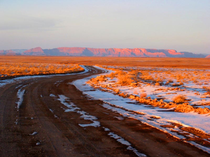
As usual at almost any overlook at the Grand Canyon, one could spend forever gazing at the magnificent sculpture wind and water has carved, the bends and curves of the canyon creating layer upon layer of successive vistas, one bhind another, almost to infinity. Beautiful! I love it! After exploring a bit and snapping a few digital photos, we ate our picnic lunch at one of the picnic tables right there at the overlook, not more than 150 feet from the edge. While the air was cool, the day was very pleasant, sunny but crisp. The southern winter sunlight left most of the south side of the canyon in shade. The large mesa directly to the south across the canyon, in the Hualapai Indian Reservation, was also beautiful, its visible north face still sprinkled with snow. By the time we turned around and began our return trip, after a pit stop at the nearby campground restrooms (the restroom there at the overlook was rather, ahem, unpleasant while those at the campground and ranger station were clean and tidy), the sun was sinking quickly in the sky. The soon-to-set winter sun lengthened the shadows and emphasized many of the surrounding landscape's features as we made our return journey, adding depth. By the time we made it back to the flat high desert plains south of Caanan Mountain and Colorado City, Arizona, the sun was setting. THe setting sun made even the stunted dry desert brush cast a long shadows across the snow, painting them in golden light. Ahead of us, Caanan Mountain's sandstone cliffs were lit in that ethereal light. What a treat!  The Painted Desert - As the sun sets on the high desert plains north of Tuweep/Toroweap and Mt. Trumbull, I just had to snap this shot of the road winding across the snowy plain toward Caanan Mountain (that's the red sandstone formation in the photo, due north of the photo location).By the time we reached Colorado City and the highway, the evening sky had passed through the entire palette of stunning sunset colors. It was the perfect end to a perfect day to the perfect place for enjoying the majesty of nature (and a picnic to boot). Wow! The Painted Desert - As the sun sets on the high desert plains north of Tuweep/Toroweap and Mt. Trumbull, I just had to snap this shot of the road winding across the snowy plain toward Caanan Mountain (that's the red sandstone formation in the photo, due north of the photo location).By the time we reached Colorado City and the highway, the evening sky had passed through the entire palette of stunning sunset colors. It was the perfect end to a perfect day to the perfect place for enjoying the majesty of nature (and a picnic to boot). Wow!
I'm posting a few photos from our trip. But mere digital snapshots just don't do justice to being there and seeing and experiencing such beauty first hand. Visit this cache site! It is well worth it. (But go prepared with a good map, good tires, plenty of water, a camera, etc.) -Astounding St. George, Utah | |